


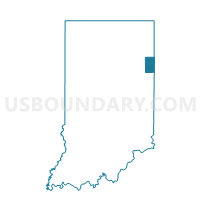
DECATUR 4, Adams County, Indiana
About
Outline

Summary
| Unique Area Identifier | 576011 |
| Name | DECATUR 4 |
| County | Adams County |
| State | Indiana |
| Area (square miles) | 0.66 |
| Land Area (square miles) | 0.66 |
| Water Area (square miles) | 0.00 |
| % of Land Area | 100.00 |
| % of Water Area | 0.00 |
| Latitude of the Internal Point | 40.84222780 |
| Longtitude of the Internal Point | -84.94561670 |
Maps


Graphs
Select a template below for downloading or customizing gragh for DECATUR 4, Adams County, Indiana


Neighbors
Neighoring Voting District (by Name) Neighboring Voting District on the Map
- DECATUR 3, Adams County, IN
- DECATUR 5, Adams County, IN
- EAST ROOT, Adams County, IN
- WEST ROOT, Adams County, IN